
2022 NARRAGANSETT BAY CHALLENGE
Historic region with myriad harbors, coves, connected inland rivers and a robust industrial port legacy.
The Envision Resilience Challenge model, a coastal resilience initiative that connects academia, local leadership and community members, first launched in the spring of 2021 as the Envision Resilience Nantucket Challenge, with the goal of inspiring coastal communities to envision innovative adaptations to sea level rise. Following the success of its inception on Nantucket, ReMain Nantucket is bringing the model to one more coastal region.
Narragansett Bay, which covers 147 miles, is the largest estuary in New England. It is home to numerous islands, harbors, ports and bodies of water including the Sakonnet River. Based on National Oceanic and Atmospheric Administration’s “high” sea level rise projections, the Bay will see nearly 4 feet of water above local mean sea level rise by 2060, more than 6 feet by 2080 and close to 9 feet by 2100.
However, like Nantucket, the communities of Narragansett Bay are well aware of the threat they face from the impacts of climate change, particularly sea level rise. Over the last decade, Rhode Island universities, local and state officials and environmental organizations have made huge strides in coastal resilience preparedness and preparation.
The Envision Resilience Narragansett Bay Challenge, a spring 2022 design studio, is calling on multidisciplinary teams of graduate and undergraduate students to reimagine at-risk sites in the Narragansett Bay region through an iterative, design-driven approach. The six participating universities in the 2022 Envision Resilience Narragansett Bay Challenge are the University of Rhode Island, Rhode Island School of Design, Roger Williams University, Syracuse University, Northeastern University and the University of Florida. Students across disciplines―landscape architecture, environmental engineering, law, journalism and economics to name a few―will be tasked with identifying threats, researching possible solutions and proposing adaptive pathways forward for selected study areas within Providence, Wickford, Newport and the adjacent towns of Barrington, Bristol and Warren.
“My heart is moved by all I cannot save: so much has been destroyed I have to cast my lot with those who age after age, perversely, with no extraordinary power, reconstitute the world.”
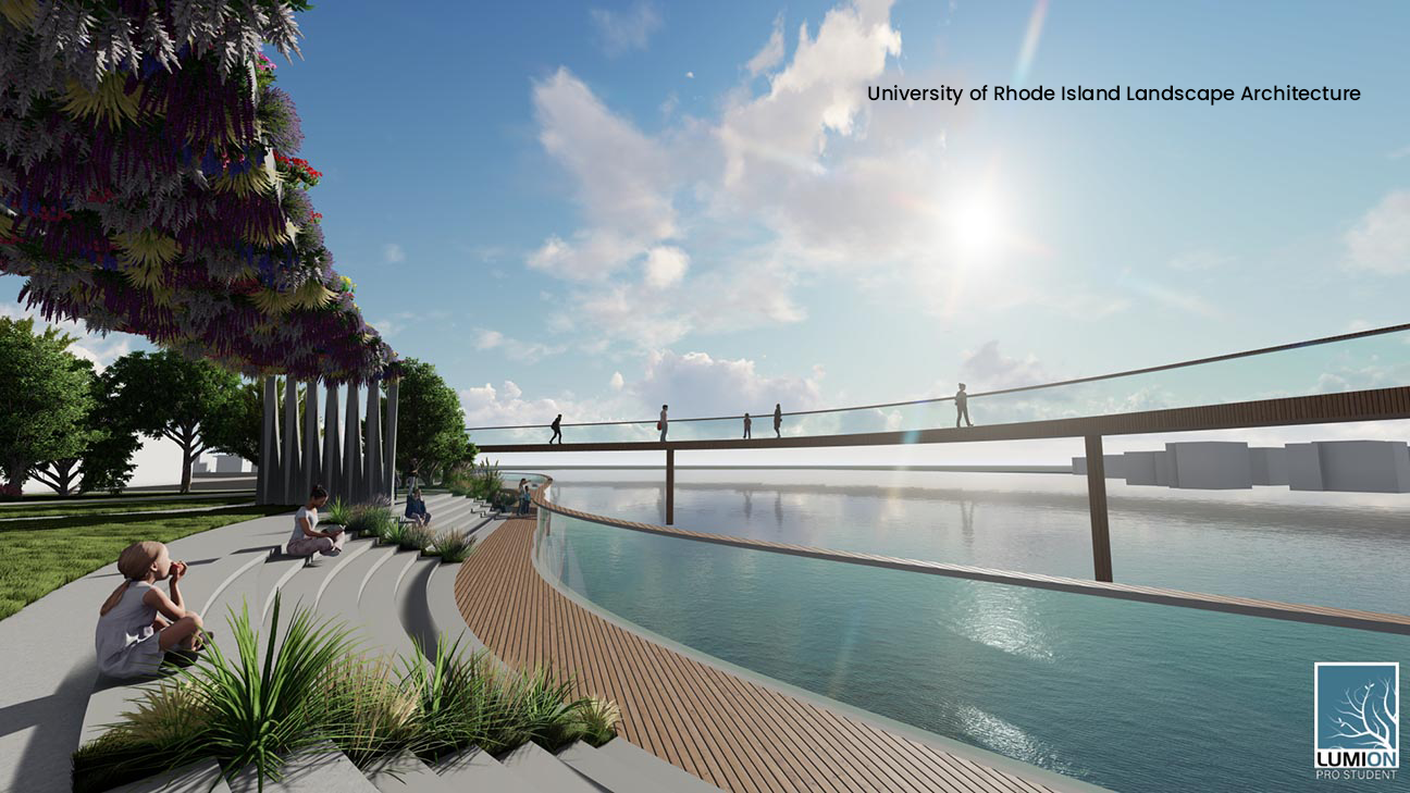
Design by Rosa Adimari 2022 (University of Rhode Island, Professor Richard Sheridan)
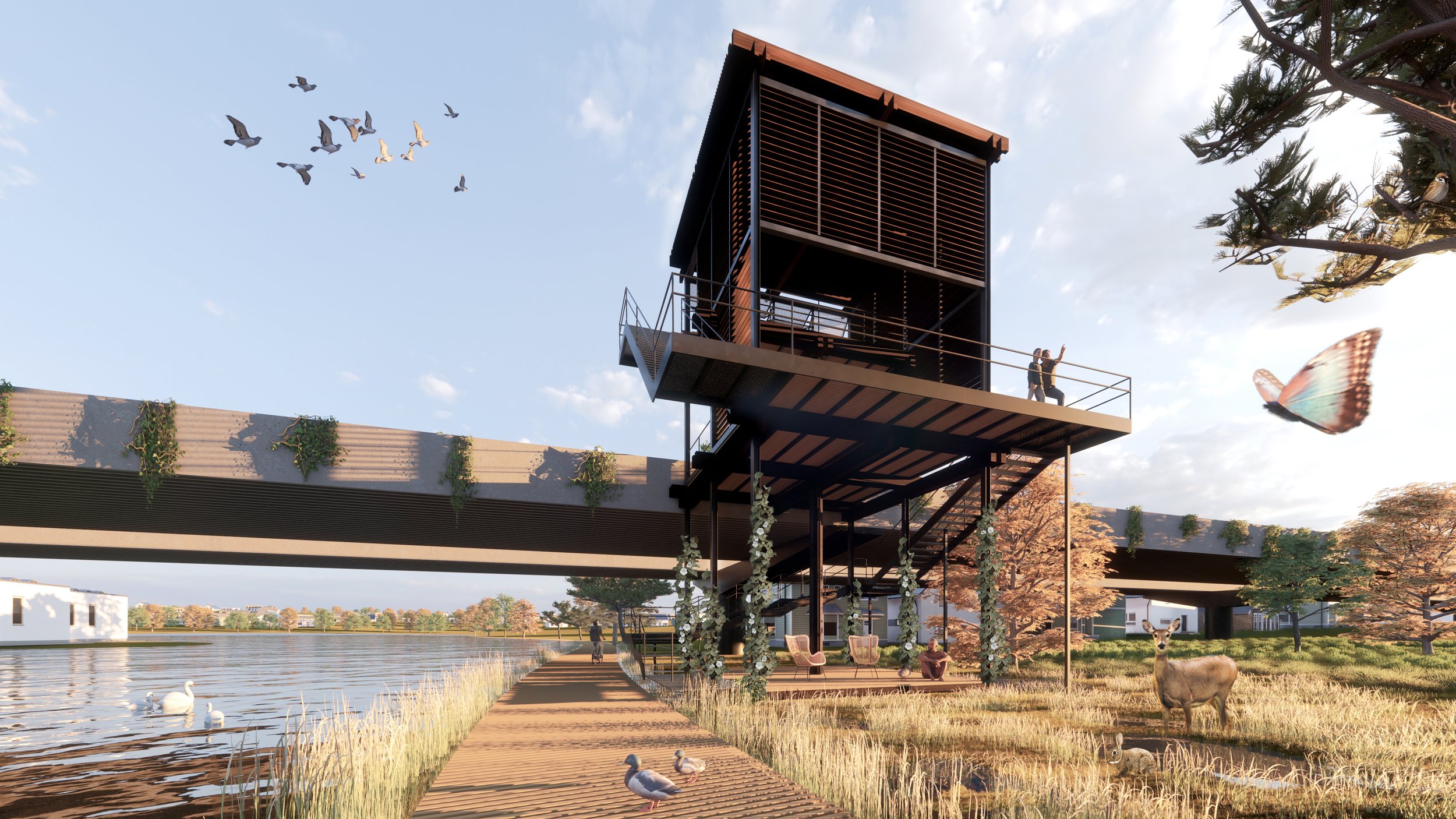
Design by Rouxi Li 2022 (Syracuse University, Professor Julia Czerniak)

Design by Tzu-Chun (Austin) Hsu 2022 (Rhode Island School of Design, Professors Anne Tate and Laura Briggs)

Design by Nora Masler 2022 (Northeastern University, Professor Sara Carr)
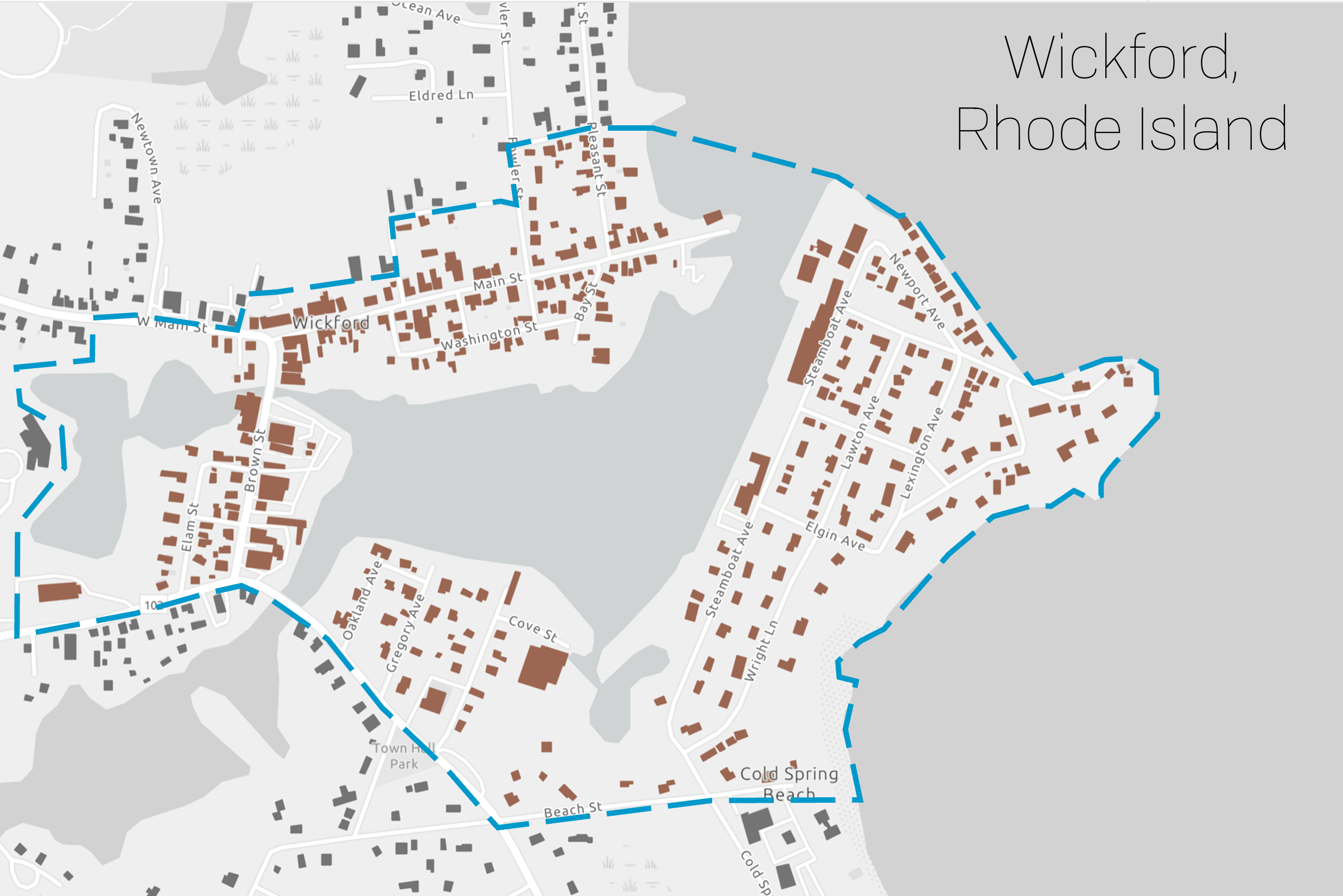
Wickford, North Kingstown

Selected Sites
Providence
Warren, Bristol & Barrington

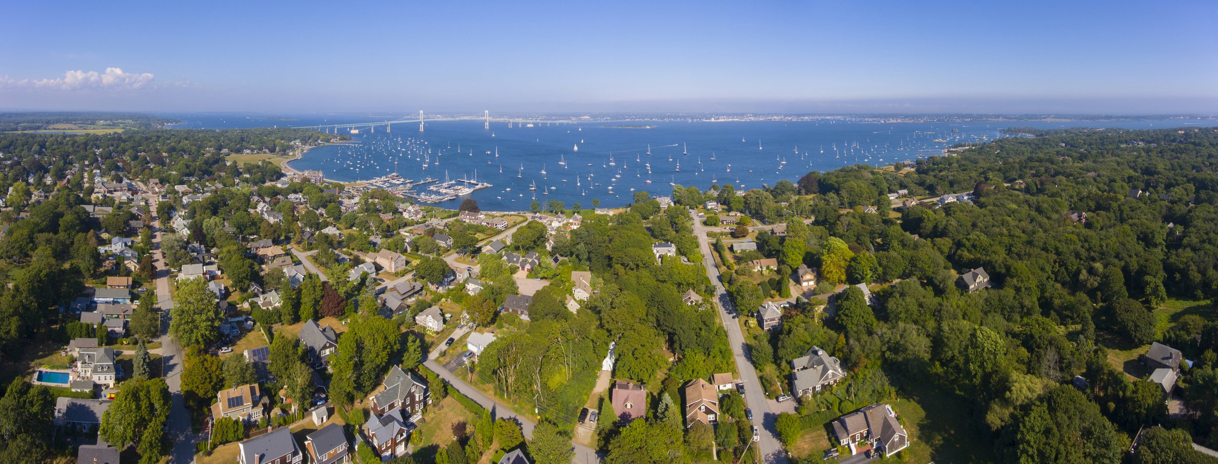
Newport

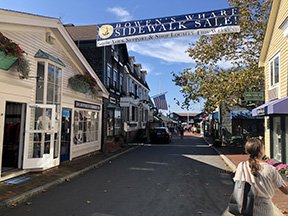
Wickford Village, North Kingstown
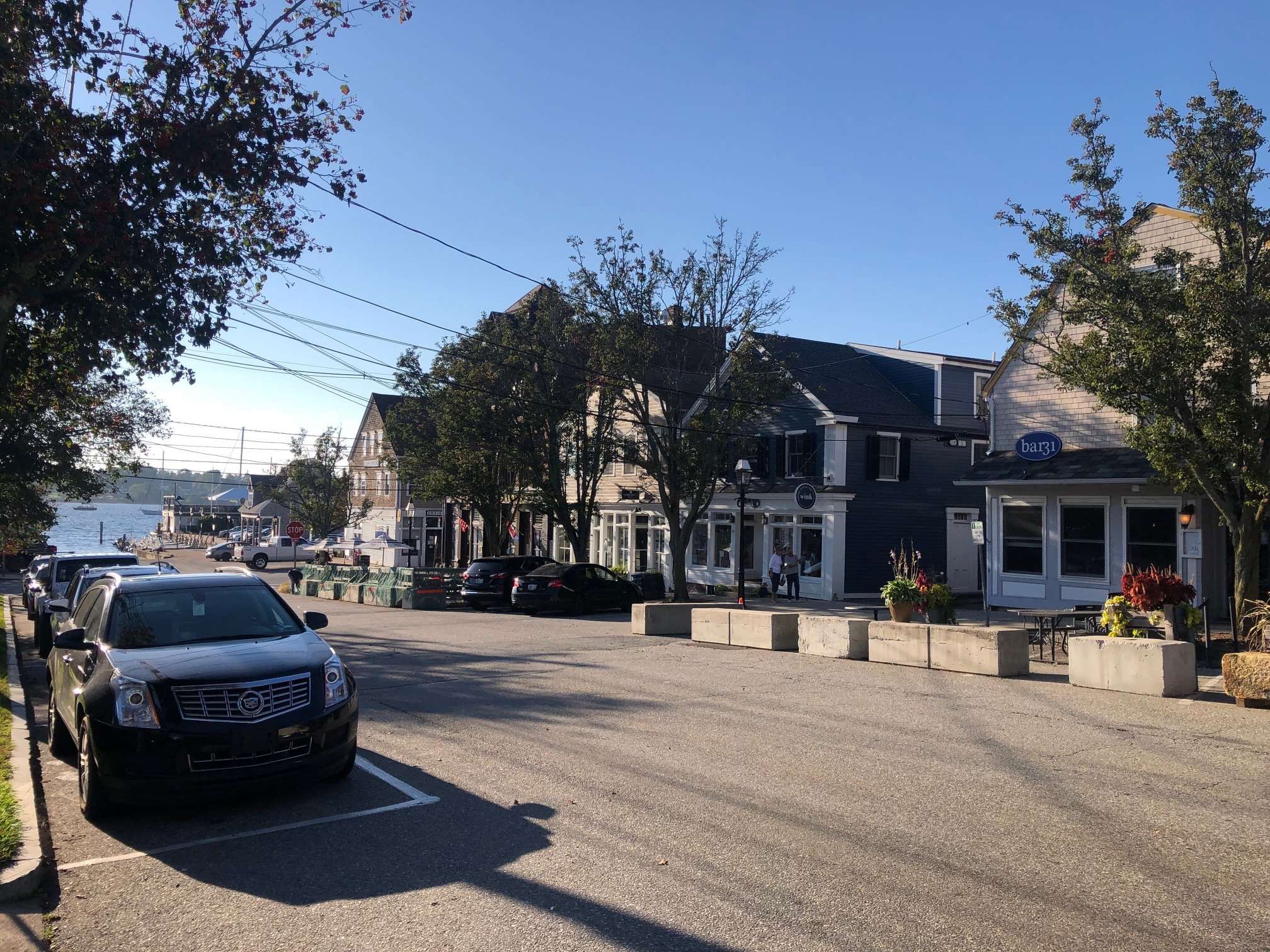
The historic village of Wickford, North Kingstown sits on the west side of the Narragansett Bay encompassing both Academy Cove and Wickford Cove (which is considered by Safe Harbor Marinas one of the foremost hurricane holes). It was originally home to the Narragansett Nation. The historic commercial core is surrounded by colonial and federal-period homes on Elam and Washington Streets. As such Wickford is one of the oldest preserved colonial villages in the country. The Historic District includes the commercial Brown and Main Streets, the harbor and several residential neighborhoods like Point Wharf.The character of the village has largely been upheld by the historic zoning by The Main Street Association.
Wickford has a long maritime and fishing history. At one time, between the 1700s to the mid-1800s, it was home to the second largest maritime community on Narragansett Bay. In those days Newport, the largest maritime community, was easily accessible by steam ferry
It’s not just its port and connection to the water that makes Wickford an interesting study area. Wickford is now connected to the cities of Providence and Boston via the MBTA Commuter Rail.
The commercial streets Phillips Rt. 102 and Boston Neck Rd. Rt. 1A provide the potential for increased economic development as a key route to Jamestown from the inland. Recently there has been renewed economic interest in creating new retail offerings in the historic setting but many business owners have stopped short in their plans because of the fears surrounding flooding and impact of sea level rise. There is some development going on, and Wickford could be on the cusp of growth but at the same time it’s quite low-lying and vulnerable. Planning is in place to provide market rate housing through the adaptive reuse of a barn and school along this commercial corridor.
The question is, can there be investments and suggestions that can secure its future? A key project will be the implementation of the Town’s plan to create a more protective and resilient harbor front on the existing parking lot.
This site will serve as a selected study area within Wickford for the Envision Resilience Narragansett Bay Challenge in the Commercial District of Brown Street, strategically positioned between the Academy and Wickford Coves.
The corner of Brown Street and Main Street is home to the “High Water Mark” metal plaque on the brick Gregory Building, indicating the September 21, 1938 Hurricane that brought waist-high water levels. The plaque is a visual reminder that Main Street, and Brown Street, would have been completely inundated.
The Wickford study area, picturesque, with a mix of shops, restaurants, galleries and homes right along the water enjoys a rich history and character. It does however regularly experience sunny-day flooding and King Tides. The Town planners currently intend to raise the Brown Street parking lot behind Walgreens by 18 inches.

Providence
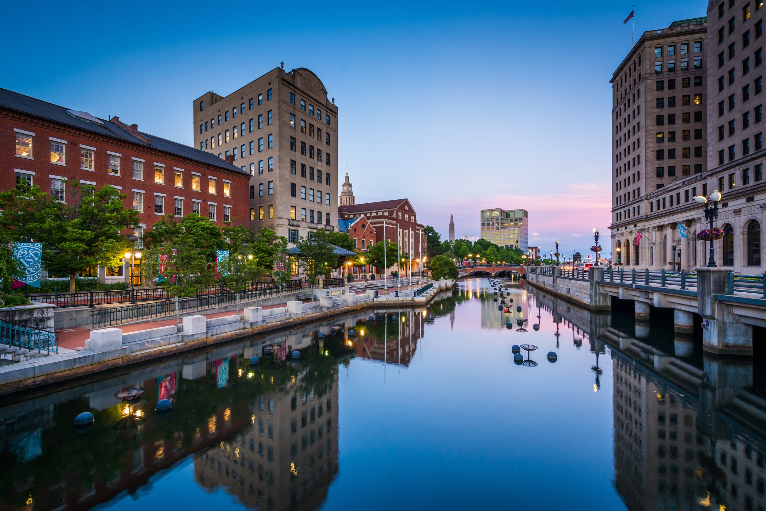
Providence, Rhode Island—the state’s capital—sits at the head of the Narragansett Bay, where the Seekonk and Providence Rivers connect and the Providence River flows into the bay. Much of downtown was built on fill, where former salt marsh and a large cove and park used to exist. The City of Providence is densely built with 18th- and 19th-Century residential neighborhoods, industrial buildings, and a low-lying central business district downtown.
Providence has a long history of significant storm events beginning in the 17th Century. Most notable are the Hurricane of 1938 and Hurricane Carol 1954, with flood levels at nearly 18ft. and 16ft. The storm surge was devastating to the city, affecting not only harborfront properties but areas deep into the city along the Providence River. Between 1960 and 1966 the Fox Point Hurricane Barrier was built with an elaborate pumping system to protect the City, located at the intersection of the harbor and Providence River. It does not provide protection to the Port and Fields Point. In the early 1990s, portions of downtown underwent major redevelopment, which included the creation of Providence’s Waterplace Park, where the cove once was.
There exists a very proud civic story about the restoration of Providence. If we put that into context: what if that was lost all over again in the 21st century?
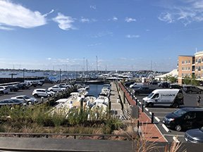
The Port of Providence, located at the convergence of Narragansett Bay and the Providence River, is New England's second biggest deep water port and a key distribution center in New England. It’s also one of the most vulnerable areas to sea level rise in the city.
The port area begins at the north of Narragansett Bay, while the more defined ProvPort is to the south at Fields Point, which is leased by the City, managed by Waterson Terminal Services, and contains the most concentrated and water-dependent port uses.
Fields Point, which is the stretch of coast that borders the Providence River as it opens up to Narragansett Bay, has a diverse range of development from industrial, container shipping to institutional use. The Washington Park neighborhood juts into Narragansett Bay right near the Providence River and Route 95. It began as a farm, was transformed into a shipyard during wartime and today, is home to not only the Providence Port, but the Narragansett Bay Commission, the Johnson and Wales Bayside Campus, Save The Bay, several public parks and more. There is a big environmental justice focus here: contamination and emissions are of great concern in port area neighborhoods. There is a history of fill and shoreline modification as well as pushback from the local community, and a disconnect still remains.
As of early January 2022, a voter-approved expansion project in the port had begun. A 6.3-acre property between the ProvPort marine terminal complex and Johnson & Wales University was purchased by the state and will be used to support future offshore wind projects, as well as other tenant uses
What’s the future of the area north of the barrier? Many believe the barrier will be effective only through 2040 with storm surge, but not effective with sea level rise. There are interfacing systems with storm water and sewage that have not been fully analyzed or planned for. Although there has been significant analysis and research for the Port and Fields Point, a visionary plan for its future has yet to be investigated. As such, this district is rich with possibilities as a subject area for the Narragansett Bay challenge given the issues and the diversity of uses and stakeholders.
Warren, Bristol & Barrington
On the East Bay sit the three connecting towns of Bristol, Warren and Barrington—the land of Sowams occupied by the Pokanoket Nation when the English settlers arrived in 1620. Despite colonial occupation, the Pokanoket—meaning “land at the clearing”—continue to live and thrive in the Sowams Heritage Area. The Pokanoket were the headship tribe of a Nation that expanded throughout New England, led by Massasoit Ousamequin (meaning “great leader”). Massasoit and the Pokanoket were the ones to welcome the English at Plymouth. In July 2021, the Town Council of Warren passed what is believed to be the first municipal Land Acknowledgement in New England.
Though not quite as popular with the summer crowds as its neighbors, the quaint, seaside town of Warren—once a bustling port for whaling and shipbuilding—still draws a steady seasonal crowd to its working waterfront and downtown shops, galleries and restaurants. The traditional and ancestral land of the Pokanoket Nation, Warren, R.I. continues to rely on its coastal location for much of its economy, way of life and recreation.
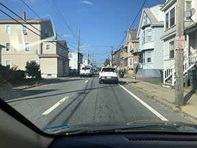
Market Street is one of the most vulnerable areas to the impacts of climate change in Warren, regularly prone to flooding and tidal surge from Belcher Cove, a small bay off the Warren River. Not only is the road at times impassable due to flooding, but local businesses and homes near Redmond Street are often the most impacted too, with the inundation of salt and storm water. The current focus in Warren is the Town-proposed Market to Metacom retreat plan—a $138 million relocation plan for low-lying Market Street neighborhood that would revitalize not just Market Street but Metacom Avenue as well. The plan is one of the first in the region to put a long-term retreat plan on the table, with the hopes of “reimagining the development of an auto-centric commercial zone into a true mixed-use, sustainably re-designed neighborhood.”
Known as the working waterfront corridor, Water Street in Warren runs along the Palmer River and abuts into Route 114 and the Warren Bridge. To the right of the bridge is the 13.8 mile-long East Bay Bike Path. This waterfront area has been able to avoid much development over the years. To the South is the Warren Town Beach and to the North is the recent successful redevelopment of the mill complex that once housed the American Tourister factory.
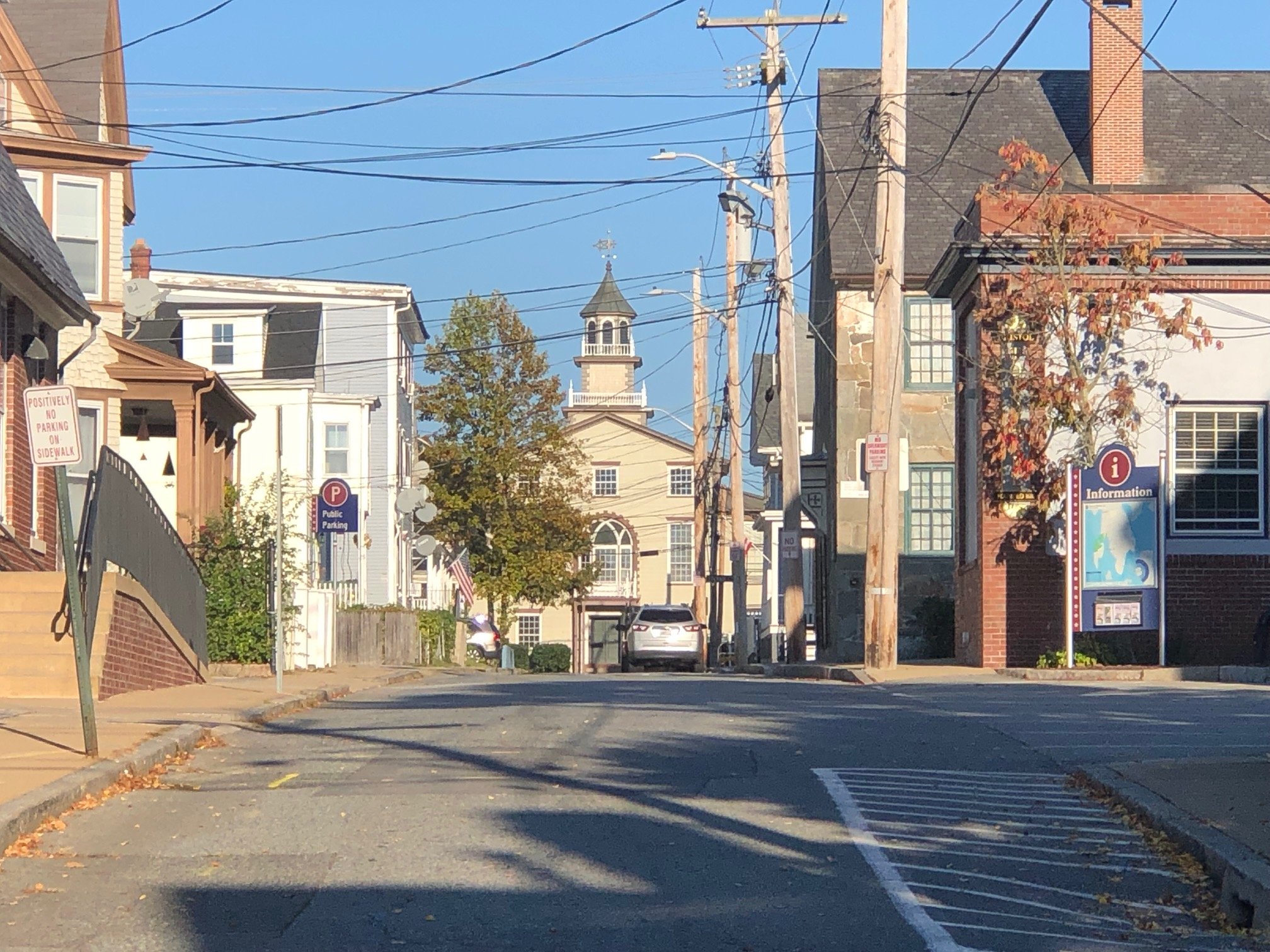
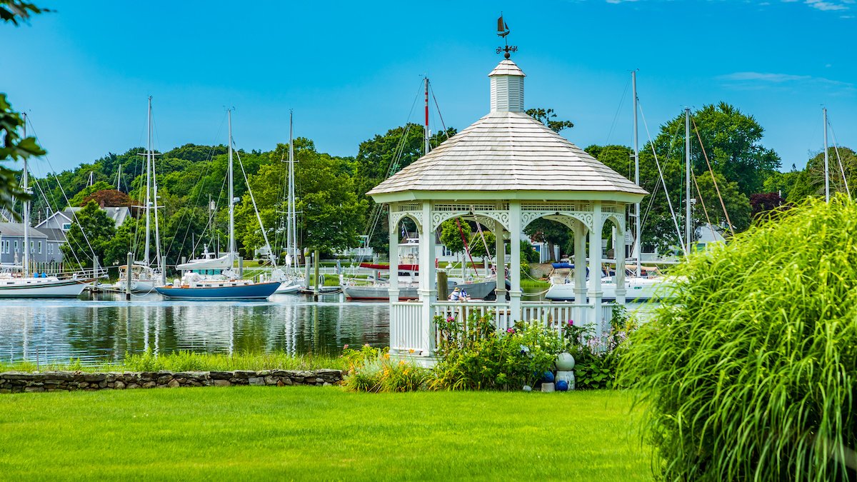
Bristol
The Bristol Waterfront Historic District is a historic district encompassing the original heart of Bristol, Rhode Island, which was laid out in 1680 by the town's original proprietors. It stretches from Bristol Harbor to the east side of Wood St., as far north as Washington Street, and south to Walker Cove.
At the south of the waterfront is the Blithewold Mansion and Gardens and the Herreschoff Boat Shops where the premier racing sailboats of the late 19Th and early 20th century were designed and built. Framing the north of Bristol Harbor is Colt State Park. Bristol is home to the oldest 4th of July Celebration and Parade that is staged along Hope St. along the Harbor.
Metacom Ave (Rt. 136) on Bristol’s eastern border continues north throughout the Town of Warren. State Rt. 114 (Hope St.) connects the towns of Bristol, Warren and Barrington.
These first two streets within the HD up from the harbor are at risk of serious sea level rise and inundation. There is momentum here for some real work to get done. A potential site/study would be identifying buildings at risk of inundation and determining long-term risk. What needs to be saved or elevated? What criteria can be leveraged to make these decisions? Answering those questions would be a huge value to The Town of Bristol.
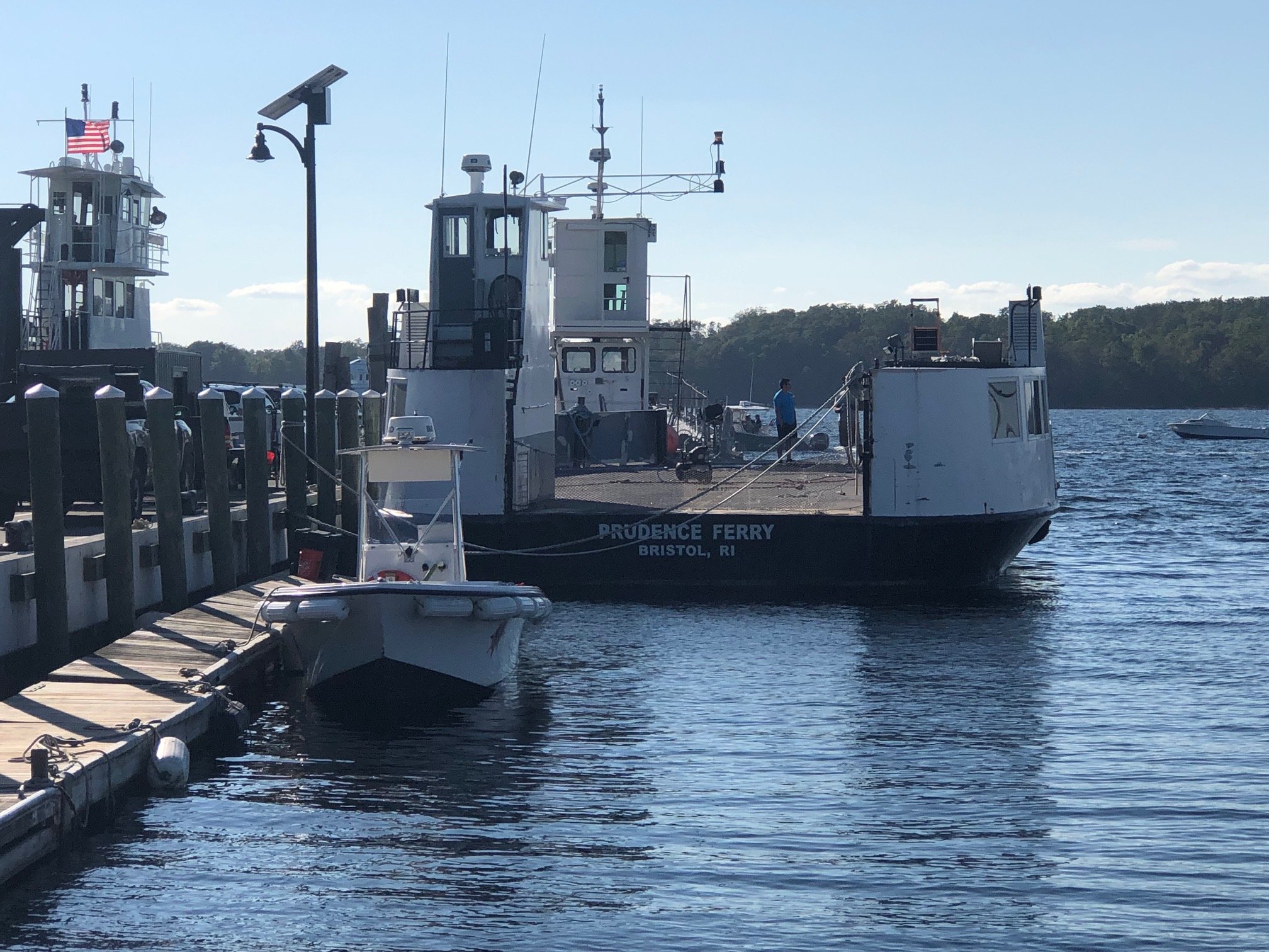
Prudence & Bay Island Transport run daily ferries, year-round between Prudence Island Bristol. A vital transportation hub, the 30-minute ferry takes passengers, bicycles and vehicles to and from Prudence Island. The ferry takes approximately 25 minutes. The ferry is run by A & R Marine Corp. to provide transportation needs to and from our island and other bay islands.
Barrington
Less than 10 miles southeast of Providence, Barringont consists of two peninsulas divided by the Barrington and Warren rivers. The low-lying town sits on mostly gravel, sand and silt soils with a western peninsula marked by many coves and indentations. Originally farmland, Barringoton saw a boom in suburban development in the 1850s with the newly built railroad to Providence. This contributed to the development of manufacturing industries.
The Town of Barrington recently purchased 25 Watson Avenue, the old Carmelite monastery site that is adjacent to the coast. It’s currently abandoned and looking for reuse. It can be viewed as a potential infill site, or a retreat area. This would make for a great site/study area for students to think through green infrastructure/adaptive reuse as an upland, dry out of floods way, location. It would still need to be built to withstand hurricane winds; with best sustainability practices. It could be a model for reuse and green infrastructure and even a net zero property.

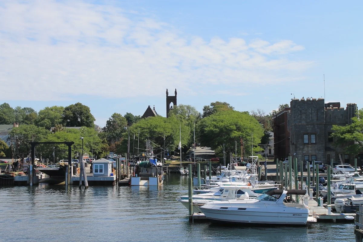
Newport
Best known for its historic mansions, sailing community and surfing, the city of Newport, Rhode Island sits at the southern tip of the Narragansett Bay on Aquidneck Island. Originally driven by the whale-oil industry, Newport’s economy has since been fueled by its location on the water which welcomes tourism, supports submarine warfare research and fosters a rich service industry. The waters of Newport have also served national defense interests.
As an island, a connection to the water is a key piece of Newport’s cultural fabric. It’s connection to Jamestown to the west is via the Claiborne Pell/Newport Bridge, to Bristol to the north via the Mount Hope Bridge and to Tiverton and Massachusetts to the east via the Sakonnet River Bridge.
To the North of the Harbor is the Naval War College occupying the entire island connected back to Newport’s mainland by bridge. At the South of the Harbor is the historic Ft. Adams State Park. Goat Island is connected by bridge to the center of the Harbor once served as the location of torpedo manufacturing. The first U.S. torpedo developed in Newport in 1869.
The Newport Historic District, which is just one of the city's three National Historic Landmark Districts, you will find one of the highest concentrations of colonial homes in the country. The Newport Historic District sits in the middle of the city, adjacent to Newport’s waterfront and includes the Easton's Point neighborhood and its colonial homes, Washington Square, the popular shops and restaurants of Thames Street as you head toward the Bellevue Avenue neighborhoods. Newport is well known for its Gilded Age mansions along Bellevue Avenue, the most famous being the 1895 mansion styled after a Renaissance palace. McKim Mead + White’s landmark Casino is located on Bellview Ave. and is home to the International Tennis Hall of Fame. A number of the Newport Mansions were designed by McKim Mead and White. The Newport Restoration Foundation has restored over 80 18th- and early 19th-century buildings across Newport and Middletown, Rhode Island.
Before Newport became home to the America’s Cup Race and a sailing yacht center its harbor was a gritty working waterfront as home to many industries. There were cotton mills, shot and lead factories, torpedo plants, tenement housing, shipbuilding and a robust fishing industry. Fortunately many of the commercial buildings of the period remain while being adapted to contemporary needs. Thames Street begins at the North with the 18th century residential district called the ‘Point’ and extends to the South all along Newport’s commercial waterfront.
There’s currently a lot of energy around educating Newporters on resiliency. In 2020, Newport received a $598,000 grant from the U.S. Department of Defense’s Office of Economic Adjustment to develop strategies to help Aquidneck Island from the impacts of storm surge and sea level rise.
Newport was home to the inaugural Keeping History Above Water (KHAW) Conference, hosted by the Newport Restoration Foundation in 2016. The conference has since convened in seven more coastal communities with the next one to take place in Norfolk, Virginia in May 2022.
Newport’s KHAW was one of the first national conversations to focus on the increasing and varied risks posed by sea level rise to historic coastal communities and their built environments. The approach was multidisciplinary so that communities could develop practical approaches to mitigation, protective adaptation and general resilience.
This district in Newport, especially The Point neighborhood, has been studied several times. If to be studied again, it would be a phase two study-perhaps feasibility study of plans that have been proposed. Consider design guidelines for rebuilding post-storm. What about water-based transportation? A study of the walkways around the Harbor?
For consideration include sites such as Waits Wharf (in need of studie(s), in the flood zone), Southern Thames (HDC) and Commercial Wharf (a big worry, at the heart of downtown).
Narragansett Bay Maps


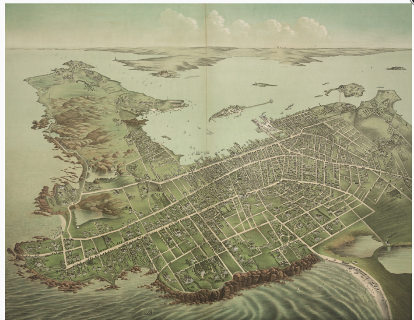


Historic Photos


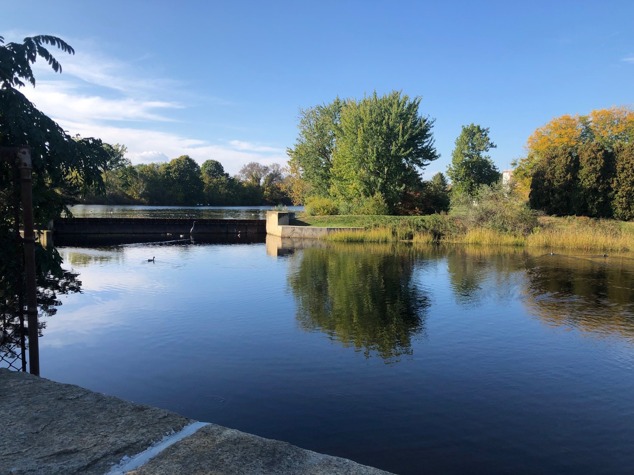
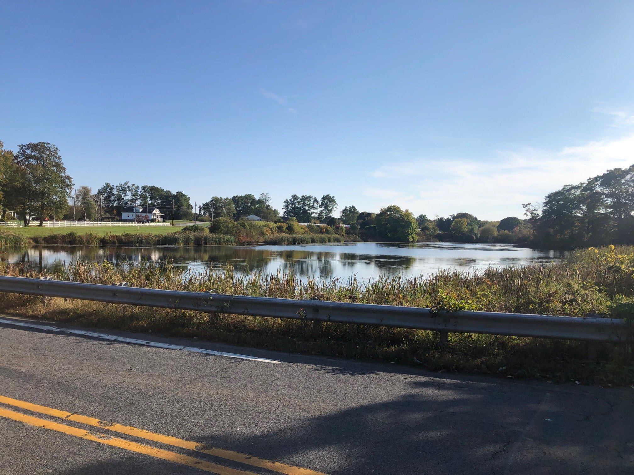
Contemporary Photos